Walking at Craibstone
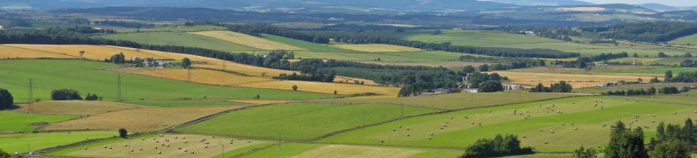
Craibstone Golf Course has a number of walking trails in the surrounding area, many with spectacular views of the course.
The variety of trails means walkers can enjoy a pleasant stroll or challenge themselves to a more demanding hike. In either case the Brimmond Bistro is an ideal place to stop before or after a walk for a light snack and refreshments.
Be sure to stop in at the Brimmond Bistro for refreshments afterwards.


Brimmond Hill walks
There are two main walks up Brimmond Hill, one starting from the North car park and one starting from the West car park.
The north car park is located right beside the golf course, and if you require directions to it please ask at the clubhouse. The route to the top of the hill is through the gate in the car park, and straight ahead. The road winds up the side of the hill, and the majority of it is tarred. Near the top it changes to a dirt road and continues to the summit, which provides spectacular views over Westhills and the golf course.
The west car park is located on the road between the A944 and the B979, about midway between the two junctions. The path from the car park leads to the top of the hill. There is no need to leave this path and the stile at the end of the fence should be ignored. Near the top the path turns to dirt and is no longer surfaced, continue to follow it and you will reach the summit.
These walks can be combined to provide a larger walk, and if you have any queries about the routes please ask at the clubhouse. Please also ensure that all gates are securely shut behind you.
Stroller's Tip
Be sure to come to the Brimmond Bistro after your walk for refreshments.


Tyrebagger walks
This walk begins from the second Tyrebagger car park on the left, travelling from the A96 junction.
The trail itself starts beside the information board in the car park, and proceeds up the slope past a gate. At the fork in the trail stay on the right path, there should be a round, flat sculpture on the left just at the fork.
The trail continues onwards for about 800 metres, there should be a deer head sculpture on the left and a “fortress” sculpture on the right. Remain on this trail until it reaches a junction; follow the small trail that cuts across a larger path. On the left of the trail there should be a field, and the trail should then cross a small stone bridge. Just after the bridge there is a sign-posted junction, continue to follow the signs for Brimmond Hill.
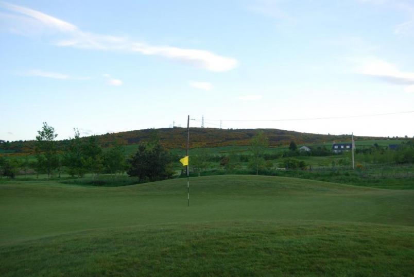
The path continues up a slight hill and runs alongside a stream; it passes a bridge on the right. The trail then sharply turns to the left up some steps, keep following the signs for Brimmond Hill. The path runs along the top of a wall and narrows at the end. At this point the trail runs parallel to the golf course, passing the 11th tee, 10th hole and the entire 9th fairway. On the right by the 10th green is March stone number 35 and by the water hazard on the 9th hole is number 36. Remain on this route until there is a junction; just beside the 18th tee.
There are two options from here to reach the clubhouse:
Option 1 – follow the trail to the right, which proceeds up a slope through the forest; this leads to the north Brimmond Hill car park. When you reach the junction with the road beside the car park, turn left and follow the road straight ahead. At the junction continue straight on, the 6th hole should be on the left and the 5th on the right. This road leads directly to the clubhouse.
Option 2 – follow the trail to the left, which runs through a small cluster of trees. The path ends on the far side of the trees, but continue straight ahead. The 8th hole should be on the left and the 18th fairway should be on the right, stay to the left of the 18th fairway. A path should branch off to the left towards the club house and leads to the club house car park.
Stroller's Tip
Quench your thirst back at the Brimmond Bistro after your hike.
Elrick Hill
Walk out of the Craibstone car park following the signpost for all forest walks (by the information board). Climb up through the trees to the 'moon pool' sculpture, forking right onto the brown trail. Continue down the hill, shortly turning right again to cross a burn (brown trail). The next junction is signed for Elrick Hill, carry on going straight as directed. There are steps on the right leading to a small picnic area but these wrap around to rejoin the path.
Emerge from the woodland onto the heather moor and follow the brown trail up to the open summit of the hill. The path quickly drops down the other side of the hill and splits by another picnic area. Take the yellow path to your left, keeping Elrick Hill on your left. This gently descends with a view over the golf course below. Proceed until you reach a yellow T-junction, turn right here and maintain your descent. Continue going straight, ignoring any rough trails crossing your path.
The path drops down further to find a small stream; cross over and follow the path around to the left, keeping the stream on your left until you see a black and white granite sculpture.
This route will continue round a bend to the right, leading onto the red trail (right) where you will soon see another sculpture on your left entitled 'Earth Chamber for the Trees and Sky'. Watch out for the viewfinders along the way to find out more about the sculptures and their artists. Beware of the European Bison lurking in the shadows to your left!
The red trail will take you back into Tyrebagger Wood before running parallel with the Kirkton of Skene road. Cutting through the eastern car park, before leading you back to the start.
Be sure to come into the Clubhouse for refreshments on your return.
Stroller's Tip
Distance: 7 kms
Approximate Time: 2 hours
Height Gain: 50 metres
OS Map: Explorer 406 - Aberdeen & Banchory